Best Hiking Trails Around Banff National Park in Canada
Disclaimer: This post may contain affiliate links. Please see our Disclosure Policy and Advertiser Disclosure for details.

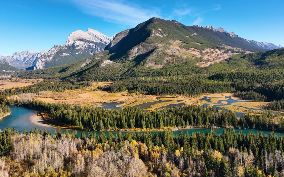
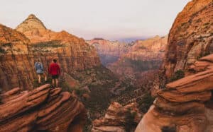
Covering 6,641 square kilometers of the Canadian Rockies, Banff National Park is Canada’s first national park, established in 1885. It’s easily one of the most visually spectacular and awe-inspiring parks in all of North America, and it really does feel like something straight out of the Swiss Alps but a lot closer to home.
If you know us, you know we’re huge fans of visiting and hiking, camping, and otherwise enjoying time spent in national parks. Whether it’s one of the United States parks or national parks in other places around the world, we’re always looking for fresh trails and new sights.
Banff National Park has over a thousand miles of trails crisscrossing throughout the park. Many people make annual pilgrimages to the park to see things they haven’t seen before and take trips at different times of year to see the park in different states and weather conditions.
What are the best trails? What do you need to know to get the most out of hiking in Banff? Let’s dig in!
Banff National Park Ground Rules and Things to Know
Before getting into the specific trail recommendations, let’s talk about more generic information you should know.
Banff, being in Canada, is relatively easy to get to as long as you have a passport and can cross the border. There’s no trans-oceanic flight to worry about, that’s for sure. Whether you’re driving up or flying into Calgary and renting a car to get to the park, it’s easy to reach.
When is the best time to hike? Any time! Though, as a mountainous area, some of the trails in Banff can be snow-bound or put you at risk of avalanches, and some can be closed. If you’re not interested in winter hiking, any time between July and September is generally your best bet.
One resource you want to keep on hand is the official page for closures. This gives you a resource that tells you when certain trails are closed or are closed to vehicles or driving. Some areas are seasonally closed, others are closed for construction or rehabilitation, and some are closed indefinitely.
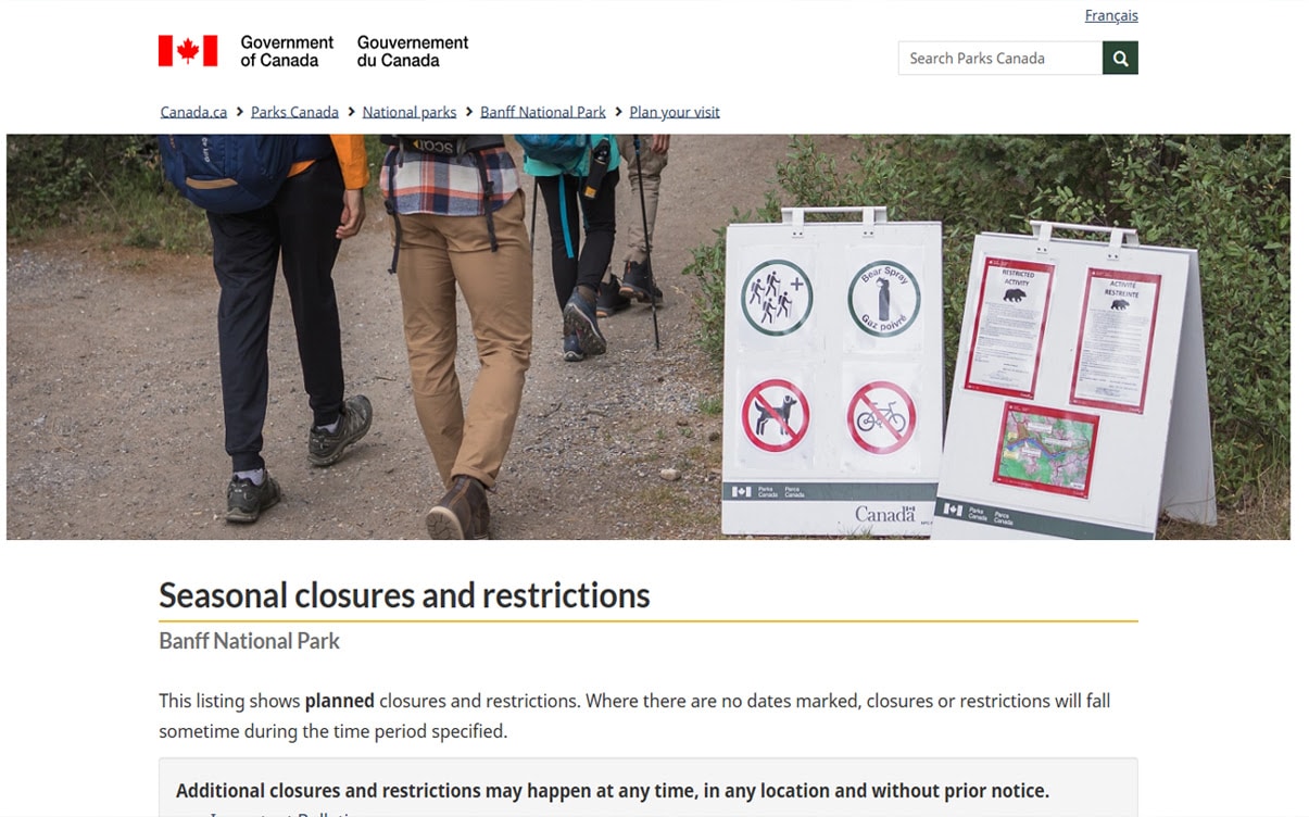
It’s also worth bookmarking the official page for trail conditions. Don’t underestimate the dangers that can come from hiking in the mountains! Pay attention to safety alerts and closures, and take it seriously when they say you should bring certain kinds of gear like cleats. It’s less of an issue if you’re hiking in the summer; just be aware.
Remember, too, that up in the mountains, it can be quite chilly and can even snow in the middle of summer if you’re at a high enough elevation. Be prepared for anything when you’re in the Rockies.
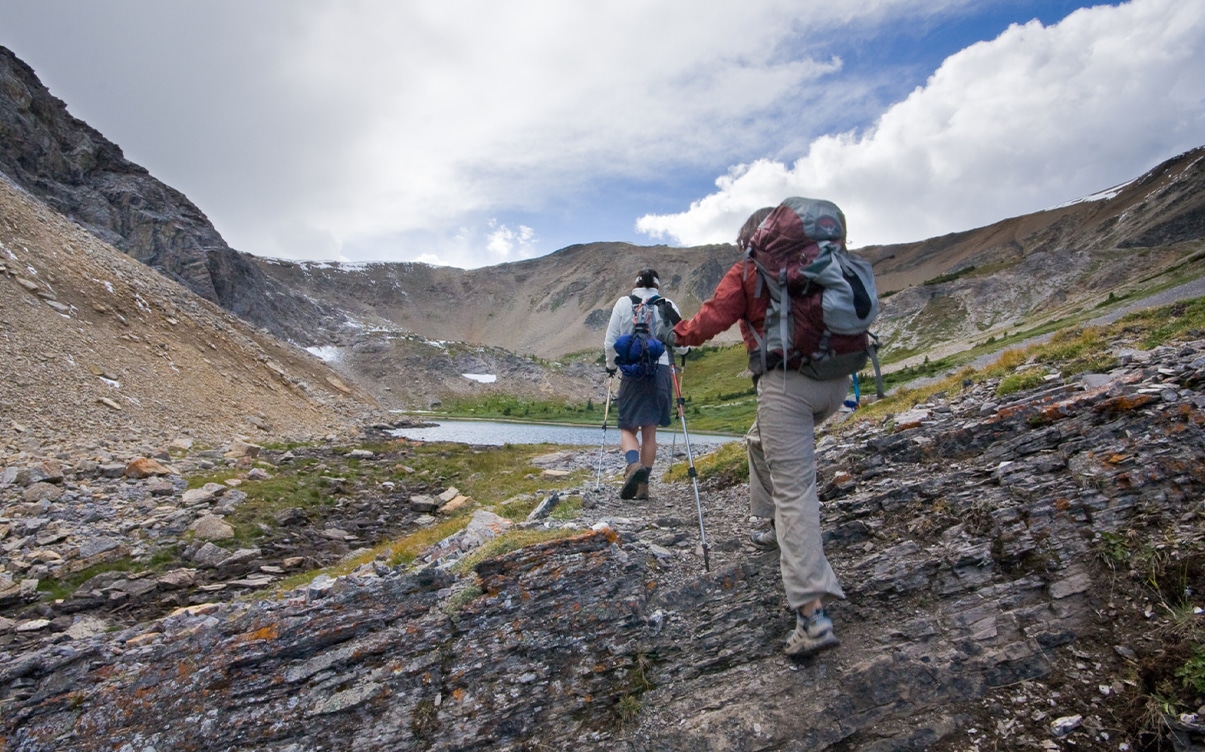
What should you bring on hikes in Banff? For the most part, your usual kind of hiking kit is going to be fine. If you don’t have one, here’s what we recommend.
- Sunscreen. Even if it’s overcast, even in the winter, sunscreen can be crucial to ensure you have a comfortable time during and after your hike.
- Good hiking shoes. Many of the trails in Banff end up wet and muddy, so get shoes that are waterproof and have good traction.
- Water. There’s not much water available in Banff; surface water can be contaminated, so you want to bring your own in.
- A first-aid kit. It’s better to have and not need it than need and not have it.
- Bear spray. Generally, you and the bears will avoid one another, but this is another tool that you really appreciate if you need it.
- A satellite communication device. Cell service is spotty at best in Banff – they didn’t exactly want to build cell towers throughout the national park – so if you get lost, injured, stranded, or otherwise need to contact someone, you need a satellite communication option.
- A trail map. Paper maps are available, and you can download the maps in PDF form and keep them on hand digitally as well.
A good pack and comfortable clothing are essential as well.
Don’t forget that you need to buy and carry a pass to the park as well. Admission is only $11 per day (though there are additional fees if you want to camp overnight in the park), which you can read about here.
One thing you should not bring is a drone. Drones are prohibited in the park, and anyone caught can be subject to arrest and fines of up to $25,000. They take it very seriously, and you should, too.
Finally, remember, this is the mountains! That means you’re starting several thousand feet above sea level. If you’re used to life a lot closer to sea level, like we are in SoCal, it can be quite an adjustment. Try to stick to easier trails for the first day or two you’re there, and tackle the harder ones when you’ve adjusted to the elevation. Trust us on this one.
The Best Hiking Trails in Banff National Park
Now, let’s get into some specific recommendations for good trails to hike. The truth is that most of the trails are good, but some are more spectacular than others.
One last detail: Banff rates trails as either Easy, Moderate, or Difficult. What scale do they use?
- Easy are suitable for first-time hikers, casual tourists, and even children. They’re gentle and have very few obstacles or elevation changes.
- Moderate are suitable for people with some trail experience. They can have short sections of steep trail or the occasional obstacle and tend to have more elevation changes.
- Difficult are meant for people who have substantial experience hiking. They can have long, steep sections, frequent obstacles, or significant changes in elevation. Some of these can feel more like climbing than hiking, too.
Which are the best trails, then? Here are our recommendations.
Fenland Trail
Fenland Trail is an easy hike, about two kilometers of simple hiking through old-growth spruce forests. It’s barely even outside of the town of Banff and barely into the park at all, but it’s a nice introduction to the area.
It has interpretive installations along the way as well, for a slightly more mentally interactive kind of hike. It’s a great option if you arrive in the middle of the day and want to do something before you settle in a hotel for the night.
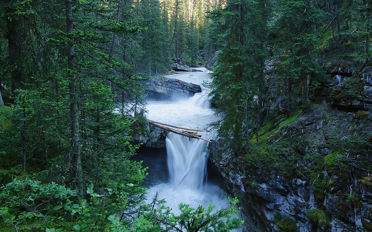
Johnston Canyon / Ink Pots
This is kind of a set of three trails, including the lower falls (a bit over a kilometer), the upper falls (2.5 kilometers), and the ink pots themselves (nearly 6 km.) All told, it becomes an easy-to-moderate hike that takes you through waterfalls, excellent viewpoints, forested trails, and the ink pots themselves. The ink pots are a set of vibrant spring-fed pools with mineral-rich waters bubbling to the surface, which are quite calming to watch and enjoy.
If you know us, you know we’re suckers for a good waterfall, and the Johnston Falls (both upper and lower) are good waterfalls. They aren’t necessarily the biggest or grandest you’ve ever seen, but they’re gorgeous, tucked away between mossy cliffs and almost hidden as they are in the trees.
One thing to be aware of is that since these trails are relatively easy and relatively close to hotels and parking, they get packed with tourists during the busiest times. Go out early to avoid the worst of it.
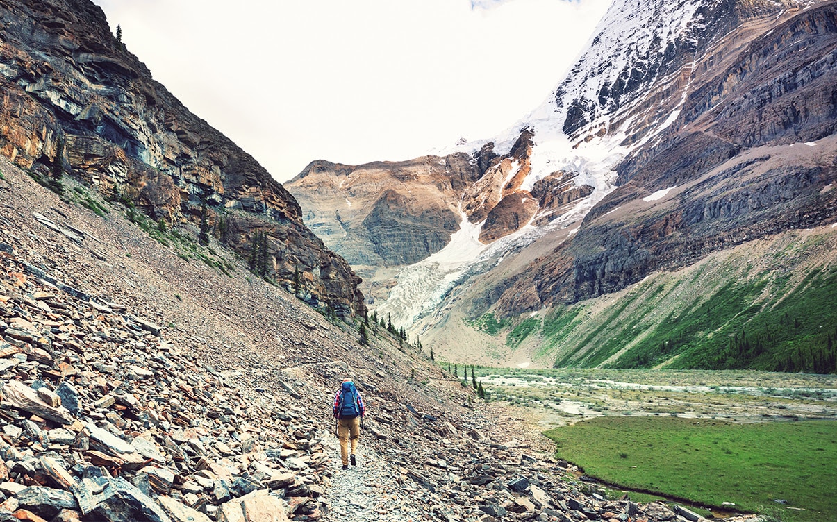
Plain of Six Glaciers
The Plain of Six Glaciers trail is a 5-kilometer trail (a bit over nine miles) as an out-and-back trail that takes you through glacier-carved landscapes and right up to the foot of a glacier itself. It’s a lengthy and challenging hike with basically no cover, and it would be thoroughly unpleasant if not for the incredible views you get everywhere you look. Whether it’s the sedate starting section along Lake Louise or the challenging final stretch to the foot of the glacier, it’s beautiful the whole way through.
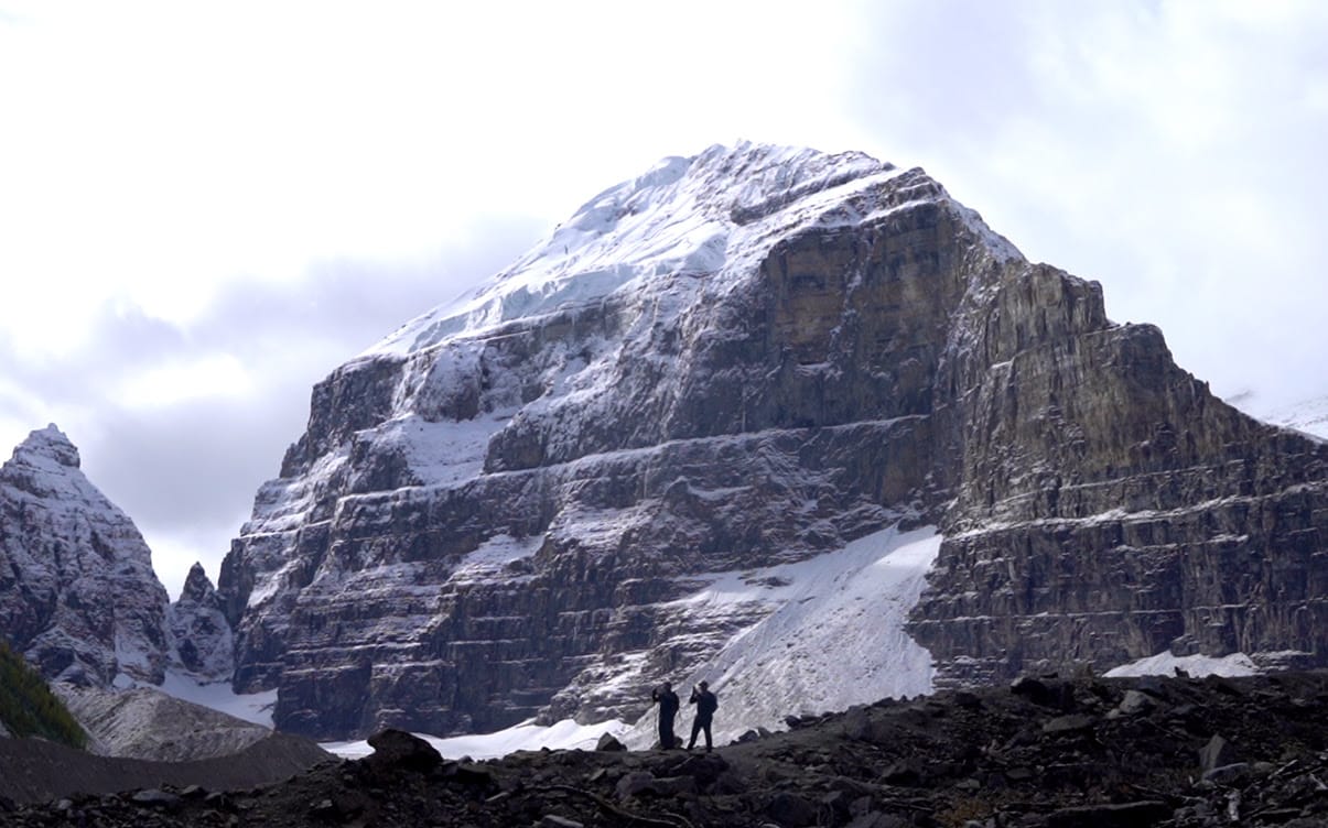
One compelling reason to take this hike is the teahouse nestled deep within the trail, right before a set of challenging switchbacks to get to the best viewpoints on the trail. It’s a great place to pause for a refresher and have a bit of caffeine to power you for the last stretch.
There’s also another set of trails that take you to the Big Beehive mountain – named such because of its shape – that also goes by the teahouse. You can take this trail and the Six Glaciers trail as a loop crossing through the teahouse if you want a slightly longer but more varied hike.
Cory Pass and Mount Edith
The Cory Pass and Mount Edith circuit is a 13-kilometer loop trail with a full kilometer of elevation gain and is one of the more difficult trails you can choose to hike. If you’re not experienced with longer and more challenging hikes, this one might defeat you, so keep that in mind.
It makes our list because it has one of the best views in Banff as your reward for reaching the end. If your legs are up to the challenge, it’s well worth the trip!
Sulphur Mountain
Another hike somewhat close to the town of Banff, Sulphur Mountain is a series of switchbacks leading to the peak of the mountain itself. The hike is considered moderate because it’s entirely uphill since you are, after all, climbing a mountain.
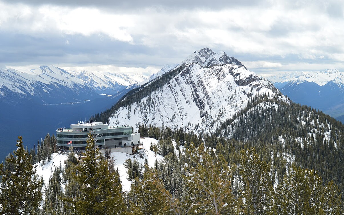
One interesting thing about the Sulphur Mountain trail is that it’s somewhat overshadowed by a gondola that takes you right to the top. You can take the gondola up and hike down, or hike up and take the gondola down and save yourself some time. The views are great, though they aren’t quite as impressive as some of the other peaks deeper in the park, it’s a lot easier to reach with the aid of the gondola.
Mount Bourgeau and Harvey Pass
If you’re interested in a long, difficult, all-day hike – or even one where backcountry camping can turn it into two days – this is a good option to consider. The trail is 21 kilometers long and takes somewhere between five and ten hours to fully hike, depending on your pace. The terrain isn’t too bad, but it’s super long and has such consistent elevation gain all throughout that it’s immensely tiring to hike.
In the end, though, you end up on the peak of Bourgeau, one of the easiest mountains to summit in the Rockies. That’s not to say it’s easy or that it’s less of an accomplishment for it, though. You are, after all, still climbing a mountain. Along the way, you also find Bourgeau Lake, which is stunningly beautiful.
Larch Valley
Larch Valley and the Minnestimma Lakes hike is a moderate-difficulty trail that takes around four hours in a round trip. It’s also a tricky hike, but not for any of the reasons you expect. The elevation gain is moderate, but the trail itself isn’t too bad. The trick is that you may be required to travel in groups of at least four people because it’s prime grizzly bear territory. Sometimes, you see the bears in the distance, sometimes you don’t, and occasionally, you see them way closer than you might expect.
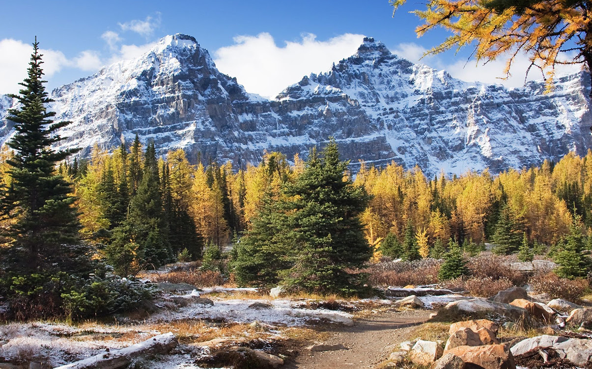
With that kind of danger, what’s the draw? In addition to the general Banff beauty, if you travel this trail in the fall when the trees are turning colors, it’s an absolutely incredible view. The timing can be tricky, but it’s not too bad if you go in early September.
Bow Summit Lookout
A trail in the Icefields Parkway section of the park, the Bow Summit trail is relatively short and easy, but since it’s further from the more popular areas of the park, it’s not likely to be as crowded as many of the other areas. It gives you a great view of Peyto Lake, the mountains all around, and the valleys below.
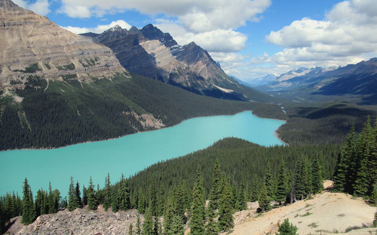
Note that we said it is less likely to be crowded; it’s still an easily accessible, easy-difficulty trail, so there can be large groups of people choosing to hike it. It’s another “get there in the morning” trail for the best experiences.
What do you think? Have we sold you on Banff? Have we left off a trail you love? Let us know what you think!


