Discover the Best Outdoor Activities Near San Francisco
Disclaimer: This post may contain affiliate links. Please see our Disclosure Policy and Advertiser Disclosure for details.

San Francisco is surrounded by some of the most stunning natural landscapes in California, offering an abundance of outdoor activities for adventurers of all levels. From scenic hikes and coastal trails to breathtaking parks and reserves, the area boasts a wealth of attractions that are sure to impress.
In this guide, we’ll explore the top outdoor activities near San Francisco, including Point Reyes National Seashore, Mt. Tamalpais State Park, Muir Woods National Monument, Golden Gate National Recreation Area, Point Lobos State Park, and Big Sur. All of these stunning spots make for amazing day trips from San Francisco to enjoy the outdoors.
Things to Know Before Visiting the Bay Area
Best Time to Visit San Francisco
The best time to visit San Francisco for outdoor activities is typically from late spring to early fall, which is from May to October. During this time, the weather is generally sunny and mild, with temperatures ranging from the mid-60s to mid-70s Fahrenheit (18-24 degrees Celsius).
Summer months, especially July and August, can be quite busy and crowded with tourists. However, it is also the peak season for outdoor events and activities. If you’re a photographer or simply hoping to witness some of San Francisco’s famous cloud inversions, this is the best time to come to try to capture the rolling fog.
However, it is important to note that the weather in San Francisco can be unpredictable and often changes quickly, even during the summer months. Be sure to check the forecast and pack layers to prepare for changes in temperature throughout the day.
If you prefer a quieter experience, consider visiting in the spring or fall. Springtime in San Francisco is known for its beautiful blooms and greenery, while fall brings cooler temperatures and smaller crowds.
How to Get Around San Francisco
San Francisco has a variety of transportation options, including public transit, ride-sharing services, and rental cars. Research and plan your transportation ahead of time to ensure that you can get to your outdoor destinations with ease.
Since most of the outdoor activities on this guide require a bit of a drive outside the city, we’d recommend driving your own car or booking a rental car the most. That way, you will have maximum flexibility while visiting, and don’t have to worry about public transport timetables or service to call ride sharing services.
Safety Near San Francisco
Like any major city, the Bay Area has its share of crime and safety concerns. Be aware of your surroundings, especially at night, and take precautions to keep yourself and your belongings safe.
Back in 2018, my friends and I actually had our car broken into in San Francisco where they smashed the windows and grabbed all the bags that were still in the car. Make sure to take all of your belongings with you when going hiking at any of the locations listed below. By leaving nothing in the car, you are making yourself less of a target to criminals.
Respect the Environment & Leave No Trace
San Francisco is home to many protected natural areas, including parks and beaches. When visiting these areas, be respectful of the environment and follow park rules and regulations. Pack out your trash and avoid disturbing wildlife or plant life.
What to Pack for Your San Francisco Outdoor Adventures
When visiting the San Francisco area, it’s important to pack appropriately to ensure that you have a comfortable and enjoyable experience. Here are some items that I recommend packing in your daypack:
- Water Bottle: Staying hydrated is essential, especially when hiking in the outdoors. Bring a refillable water bottle to keep yourself hydrated throughout the day.
- Snacks: Bring snacks to keep your energy levels up during your visit. Consider packing trail mix, energy bars, or fruit.
- Sunscreen: The sun can be strong in the Bay Area, even on cloudy days. Protect your skin by packing sunscreen and applying it regularly.
- Hat/Sunglasses: Bring a hat and sunglasses to protect your face and eyes from the sun’s rays.
- Layers: The weather near San Francisco can be unpredictable, so it’s important to pack layers. Bring a lightweight jacket or sweater to stay warm if the temperature drops.
- Comfortable Shoes: The San Francisco recreation areas on this guide have several hiking trails of varying difficulty, so it’s important to wear comfortable shoes that are appropriate for hiking. Sturdy sneakers or hiking boots are recommended.
- Map/Guidebook: Each spot listed below has several hiking trails, so it’s helpful to bring a map or guidebook to help navigate the areas.
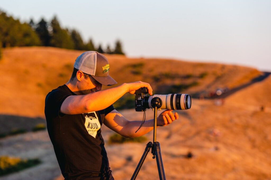
- Camera: You’ll want to capture the beauty of SF! Bring a camera or smartphone to take photos and create lasting memories. If you’re looking for great travel photography cameras, check out our favorites here.
The Best Outdoor Activities Near San Francisco
Point Reyes National Seashore
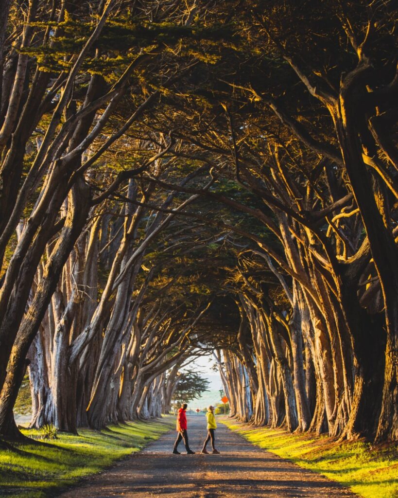
Located just an hour’s drive north of San Francisco, Point Reyes National Seashore is a rugged wilderness area that boasts some of the most stunning coastal views in the region.
Best Things to Do at Point Reyes National Seashore
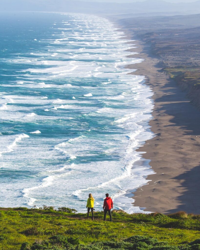
- Explore the Beaches: Point Reyes has several beautiful beaches to explore, including Limantour Beach, Drakes Beach, and South Beach. Take a stroll along the shore, hunt for seashells, or simply relax and enjoy the stunning ocean views.
- Walk Through the Famous Cyprus Tree Tunnel: See the beautiful light rays shine through the Cyprus Trees at the famous Tree Tunnel. The best time to go is definitely at golden hour at sunrise or sunset. Beware, it may be busy, as this spot is probably the most Instagrammable location in Point Reyes.
- Hike the Trails: Point Reyes has over 150 miles of hiking trails that wind through forests, grasslands, and along the coast. Some of the most popular hikes include the Tomales Point Trail, the Bear Valley Trail, and the Alamere Falls Trail.
- Visit the Lighthouse: The historic Point Reyes Lighthouse, located at the westernmost point of the park, offers breathtaking views of the rugged coastline.
- Wildlife Watching: Point Reyes is home to a diverse array of wildlife, including Tule Elk, coyotes, gray whales, and elephant seals. Take a wildlife viewing tour, or simply keep your eyes peeled while hiking or exploring the beaches.
Mt. Tamalpais State Park

Mt. Tamalpais State Park is a beloved destination for hikers and nature lovers alike, offering miles of scenic trails that wind through redwood groves and grassy meadows. This is one of our personal favorite spots in the Bay Area as Mt. Tamalpais sunsets are truly something else.
Mt. Tamalpais Weather
The weather at Mount Tamalpais can vary widely depending on the season and time of day. In general, the Mount Tamalpais weather forecast is typically cool and often foggy, with temperatures ranging from the mid-40s to the mid-60s Fahrenheit.
During the winter months, from December through February, the park can experience heavy rainfall and occasional snowfall at higher elevations. The spring months, from March through May, are generally mild with occasional rain showers. Summer months, from June through August, are typically the driest and warmest, with temperatures ranging from the mid-50s to the mid-70s Fahrenheit.
Fall, from September through November, can be a beautiful time to visit, with mild temperatures and changing fall foliage. However, the park can also experience occasional rain and wind storms during this time.
It’s always a good idea to check the weather forecast before visiting Mount Tamalpais and to dress in layers, as the temperature can vary widely throughout the day. Additionally, be prepared for the possibility of fog, which can limit visibility and make hiking more challenging.
Mount Tamalpais Webcam
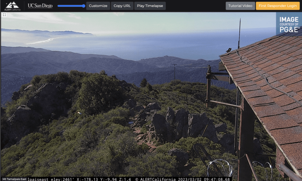
There are several live webcams of Mount Tamalpais available to check the weather or photography conditions in advance. Check them out here to check them out in real time for your reference.
Best Hikes & Viewpoints in Mount Tamalpais State Park
- East Peak Mount Tamalpais Trail: This trail is a moderate 1.7-mile hike that leads to the summit of Mount Tamalpais, with stunning views of the Bay Area. This area is a beautiful spot to go for sunset.
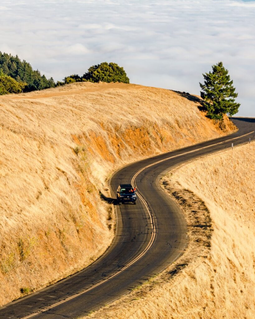
- Trojan Point Scenic Overlook: This is probably our favorite viewpoint in the whole park for sunset. Trojan Point overlooks the gorgeous Pacific Ocean, rolling hills, and the winding roads of Mt. Tam.
- Cataract Falls Trail: A 3-mile hike that takes you past multiple waterfalls and through lush forests.
- Muir Woods to Mount Tamalpais: If you’re looking for a longer, more challenging hike, this one is for you. This trail is a strenuous 10-mile hike that takes you through Muir Woods and up to the summit of Mount Tamalpais.
If you’re planning on shooting one of the famous sunsets on Mount Tamalpais, we’d highly recommend investing in a telephoto lens to capture the compression of the clouds. For all of our camera gear recommendations, check out what we currently are using in our camera bag.
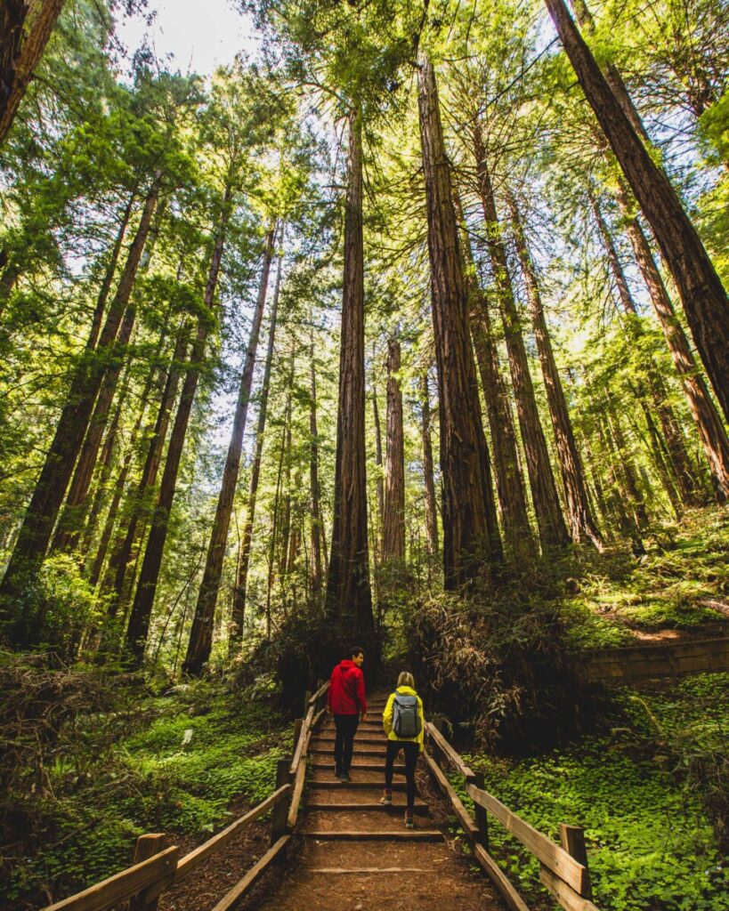
Muir Woods National Monument
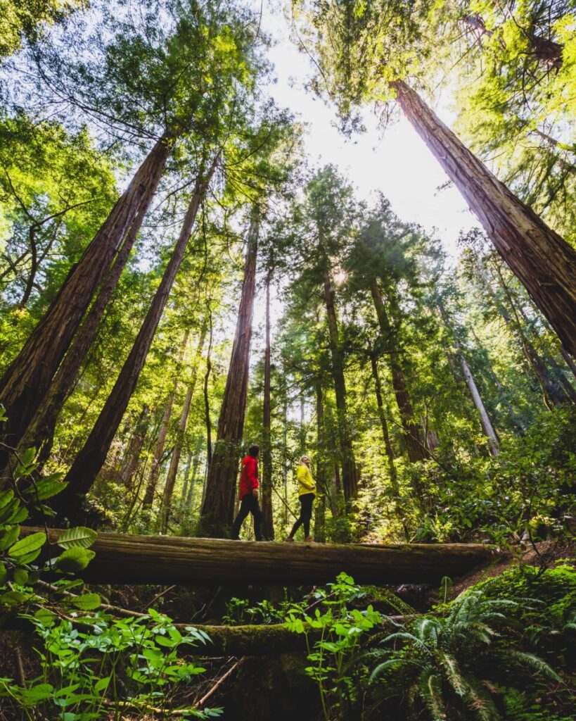
Neighboring Mt. Tamalpais is the gorgeous Muir Woods National Monument. This monument is a must-visit destination for anyone exploring the Bay Area’s natural wonders. This ancient redwood forest is home to some of the tallest trees in the world, and visitors can explore the park’s trails on foot or via a guided tour. It makes for the perfect day trip from San Francisco.
Muir Woods National Monument Tickets
Due to its popularity, Muir Woods does, unfortunately, now require advanced reservations to visit. The massive influx of visitors and parking issues subsequently caused the National Park Service to now limit entry per day. It costs $15.00 USD per adult to enter, however, if you have the America the Beautiful National Parks Pass, you and up to 3 other adults may be admitted using that pass.
To make your timed entry reservation for Muir Woods, simply follow the portal here.
Parking at Muir Woods National Monument
Parking at Muir Woods National Monument can be quite challenging even with the advanced ticket requirement, particularly during peak tourist season or on weekends. The parking lot at Muir Woods is relatively small, with only around 200 spaces, and fills up quickly. Once the parking lot is full, visitors will need to park in overflow lots and walk or take a shuttle to the main entrance. We’ve visited several times and only scored a spot in the main parking lot one time, so be prepared to take an additional walk.
Also, it’s worth noting that parking restrictions are strictly enforced, so be sure to park only in designated areas to avoid getting a ticket or having your car towed.
Best Hiking Trails in Muir Woods
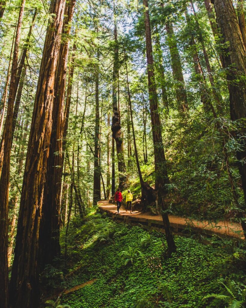
Muir Woods National Monument is a stunning destination for hiking enthusiasts. With its towering redwoods, babbling brooks, and sweeping vistas, it offers a wide range of hiking options for visitors of all skill levels. Here are some of the best hikes to do in Muir Woods National Monument:
- Main Trail Loop: This 2-mile loop is one of the most popular hikes in Muir Woods. It takes visitors through the heart of the forest, past some of the tallest trees in the park, and along the banks of Redwood Creek. Combine the Hillside Trail with the Redwood Creek Trail.
- Dipsea Trail: This 4.5-mile trail offers stunning views of the Pacific Ocean and San Francisco Bay. It starts at Muir Woods and follows a steep, switchback-filled route up to the top of Cardiac Hill.
- Ben Johnson Trail: This 5.5-mile loop takes visitors through some of the most remote and tranquil parts of Muir Woods. It offers a chance to escape the crowds and experience the quiet beauty of the redwood forest.
- Muir Beach Overlook Trail: This 1-mile trail offers stunning views of the coast and is a popular spot for whale watching. It starts at the Muir Beach parking lot and follows a steep but well-maintained path to the overlook.
If you are trying to see the magical sun rays poking through the gorgeous Redwood trees on your hike, try to make your reservation for the late afternoon!
Whether you’re a seasoned hiker or a casual nature lover, there’s something for everyone at Muir Woods National Monument. So lace up your hiking boots and get ready to explore this stunning natural wonder!
Muir Woods National Monument Tours
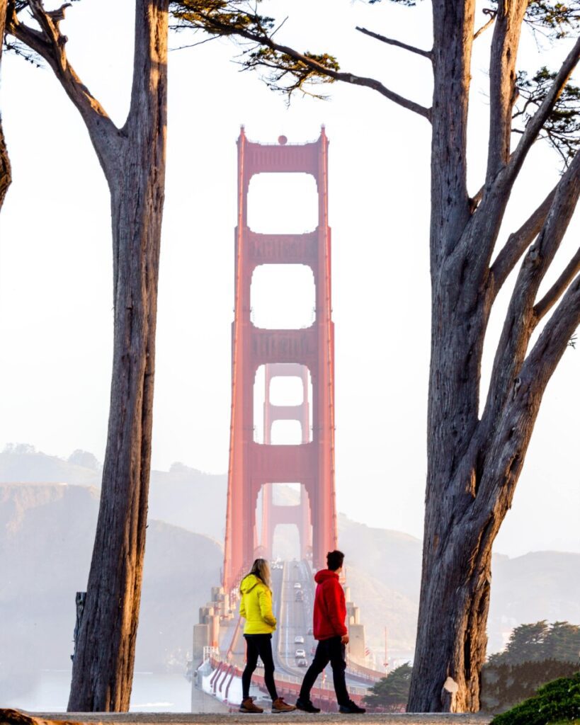
Golden Gate National Recreation Area
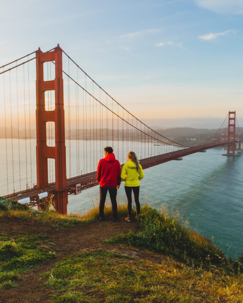
The Golden Gate National Recreation Area is a massive park that spans over 80,000 acres of land and water, encompassing everything from beaches and wetlands to historic landmarks and scenic overlooks. Here are some of our favorite viewpoints of the Golden Gate Bridge and short hikes to do when visiting:
- Battery Spencer – This historic military battery offers a panoramic view of the Golden Gate Bridge and San Francisco Bay. It’s a popular spot for photographers, especially during sunrise and sunset.
- Fort Point – This fort at the base of the Golden Gate Bridge offers unique angles and perspectives for photographing the bridge. You can capture the bridge’s full span from the fort’s rooftop.
- Baker Beach – This beach offers a stunning view of the bridge with the ocean in the foreground. It’s a popular spot for sunset photography.
- Marshall’s Beach – This secluded beach is located at the base of the Golden Gate Bridge and offers unique angles for photographing the bridge. It’s a popular spot for sunrise and sunset photography.
- Crissy Field – This waterfront park offers a great view of the Golden Gate Bridge with the city skyline in the background. It’s a popular spot for photographing the bridge and the surrounding scenery.
Point Lobos State Natural Reserve
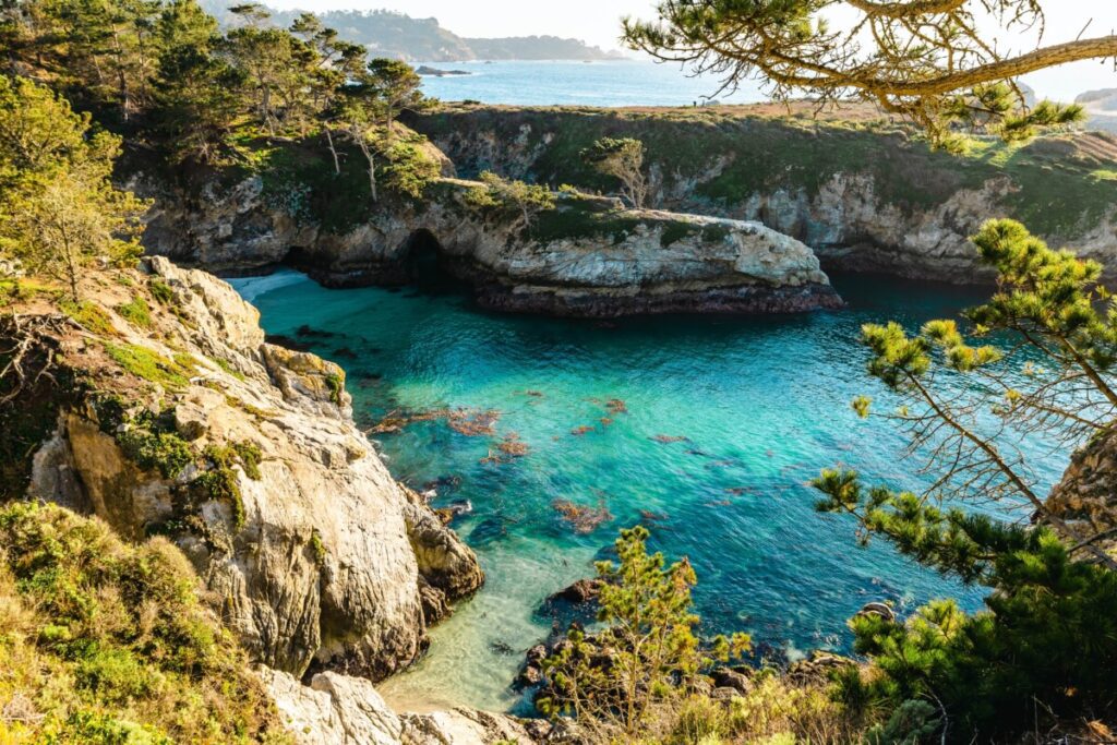
Located a few hours south of San Francisco, Point Lobos State Natural Reserve is a stunning coastal reserve that’s home to a variety of wildlife, including sea lions, harbor seals, and sea otters. Although 2 hours away, Point Lobos is definitely one of the best day trips from San Francisco.
Parking at Point Lobos
Point Lobos State Natural Reserve has several parking areas. However, they can fill up quickly, especially during peak season and on weekends. We would recommend arriving early in the morning or later in the afternoon. This will increase your chances of finding a parking spot. If the parking lots are full, you may have to wait for a spot to open up or park in a nearby area along the highway and walk to the reserve.
Best Point Lobos State Natural Reserve Trails
Point Lobos State Natural Reserve is a beautiful and diverse area that offers a range of hiking trails for visitors to enjoy. Here are some of the best trails to explore in Point Lobos:
- Cypress Grove Trail: This 0.8-mile trail takes visitors through a beautiful cypress grove, with stunning views of the Pacific Ocean. The trail is relatively easy, with only a few gentle inclines and declines.
- Sea Lion Point Trail: This 0.6-mile trail leads visitors to a rocky outcropping that is home to a colony of sea lions. The trail offers stunning views of the coastline and is a great spot for whale watching during the winter months.
- Bird Island Trail: This 0.7-mile trail takes visitors to a small island that is home to a variety of seabirds, including pelicans, cormorants, and gulls. The trail offers stunning views of the ocean and is a great spot for birdwatching.
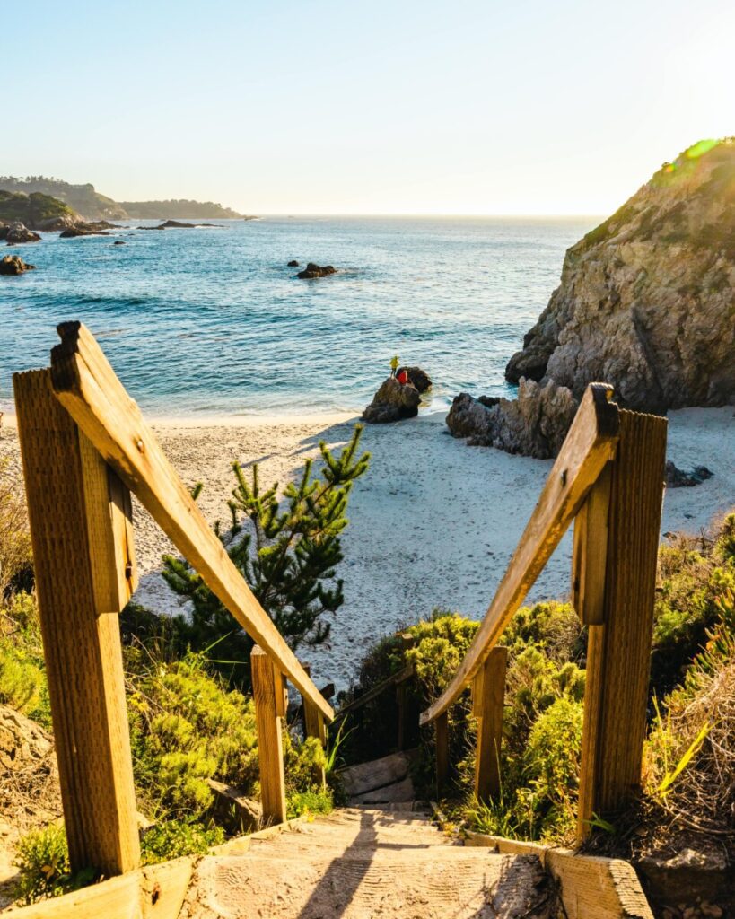
Our favorite hike in the park is the Bird Island Trail. This trail leads you the famous China Cove and Gibson Beach. To get to China Cove in Point Lobos, drive to the end of the park road, where you will find parking for the Bird Island Trail. A short two minute walk away, the beautiful blue water will greet you from down below. Bird Island Trail is one of the most scenic easy hiking trails in Monterey.
Finally, along the trail, you will find some steep wooden stairs that lead down to Gibson Beach. We loved hanging out on this beach. The view of the Monterey coast line with endless Cyprus trees is stunning. If you are planning to stick around in Monterey, check out our full guide to exploring the area in a weekend here.
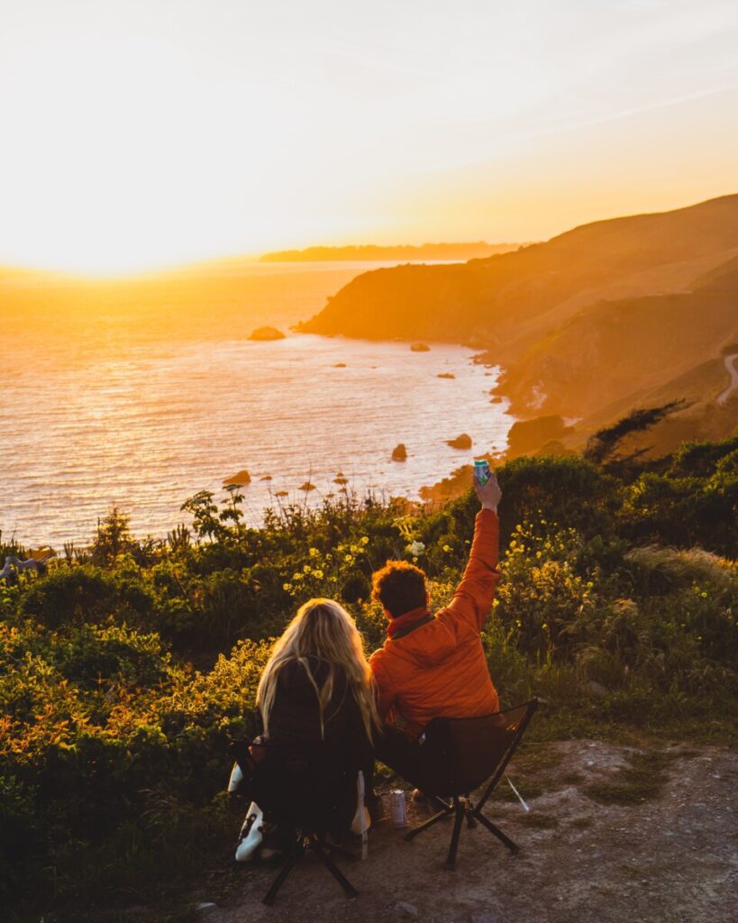
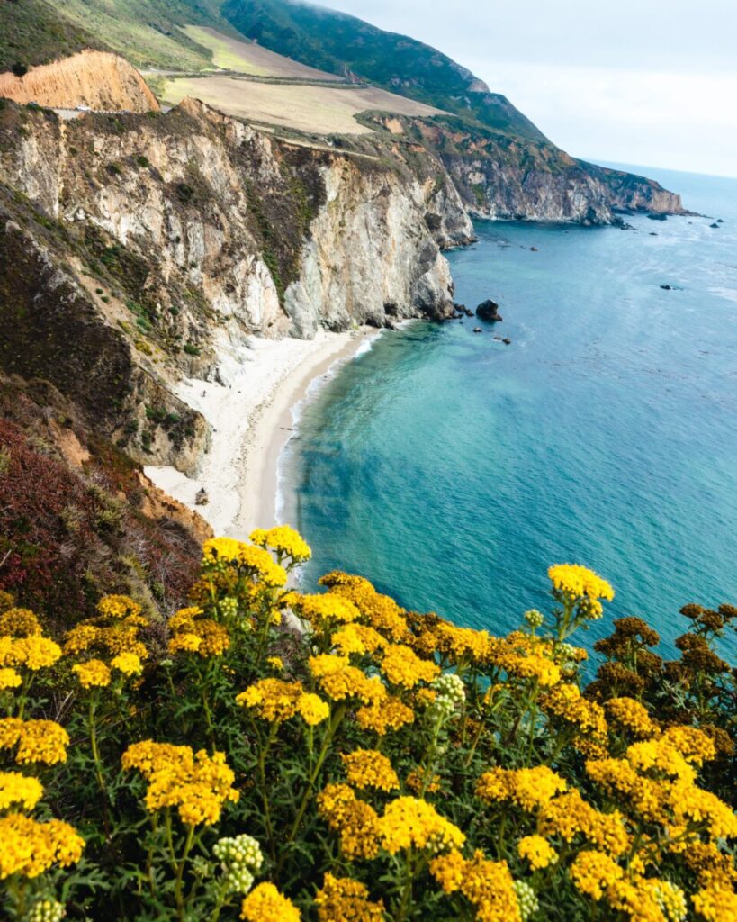
Big Sur

No visit to the Bay Area is complete without a road trip down the iconic Big Sur coastline. This scenic drive takes visitors along some of the most breathtaking stretches of highway in the world, with views of rugged cliffs, pristine beaches, and sparkling ocean vistas.
Best Time to Visit Big Sur
The best time to visit Big Sur is during the spring (April and May) and fall (September and October) when the weather is mild, and the crowds are smaller. During these months, temperatures are typically in the 60s and 70s, making it perfect for outdoor activities like hiking and camping.
The summer months (June to August) are also popular, however, the area can get crowded, and temperatures can be warmer, reaching into the 80s and sometimes 90s. It is also important to note that wildfires can occur during the summer months, which can impact air quality and road closures.
Winter (December to February) in Big Sur can be rainy and cooler, but it is still a beautiful time to visit, especially for those who enjoy storm watching and seeing waterfalls at their fullest. However, it’s important to check road conditions before visiting during the winter months, as some roads may be closed due to weather or landslides.
No matter which time of year you decide to visit Big Sur, you basically can’t go wrong.
Big Sur’s Top Highlights to Visit

There are many beautiful spots to visit in Big Sur, but here are some of the most popular:
- Pfeiffer Beach – a stunning beach with purple sand and rock formations.
- Bixby Bridge – an iconic bridge with sweeping views of the coastline.
- McWay Falls – a picturesque waterfall that drops onto a sandy cove.
- Julia Pfeiffer Burns State Park – a park with hiking trails, waterfalls, and panoramic ocean views.
- Andrew Molera State Park – a park with hiking trails, beaches, and scenic river views.
- Garrapata State Park – a park with hiking trails, beaches, and rocky coves.
- Pfeiffer Big Sur State Park – a park with hiking trails, redwood groves, and a scenic river.
These are just a few of the many incredible spots to visit in Big Sur. It’s a place where natural beauty abounds, so be sure to take some time to explore and discover your own favorite spots. Additionally, if you’re hoping to do a longer road trip from San Francisco that includes Big Sur on the itinerary, we’d also highly recommend driving Highway 1 all the way down to Los Angeles.
Ready to Explore the Outdoors Near San Francisco?
Whether you’re a seasoned adventurer or a nature lover looking for a peaceful escape, the Bay Area has plenty to offer. From Point Reyes to Big Sur, the region’s natural beauty is truly unparalleled, and there’s no better way to experience it than by exploring the area’s top outdoor activities. So grab your hiking boots, pack your camera, and get ready for an unforgettable adventure!


